February’s Map of the Month shows Buglife’s Yorkshire Important Invertebrate Areas!
Read MoreJanuary’s Map of the Month shows a heat map of bat record density across the NEYEDC area!
Read MoreDecember’s Map of the Month shows farmland bird survey data mapped against crop type!
Read MoreNovember 2024’s Map of the Month shows UAV scrub mapping at Bull Ings SSSI, Cropton!
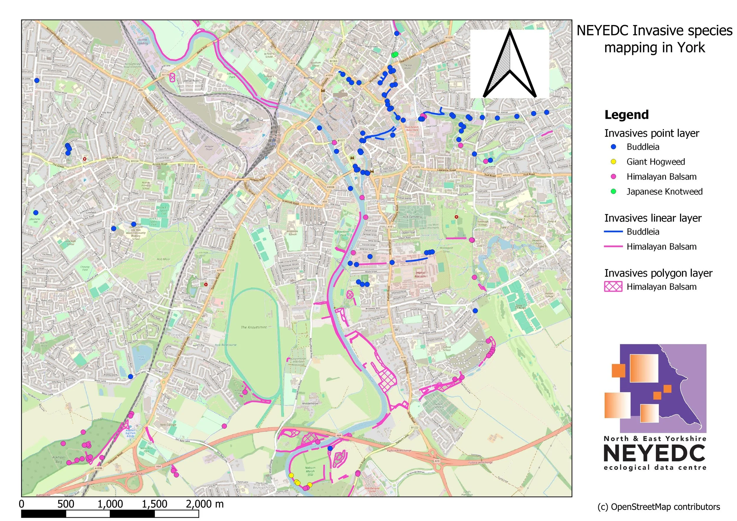
Read MoreOctober 2024’s Map of the Month features invasive non-native species (INNS) data collected by NEYEDC staff!
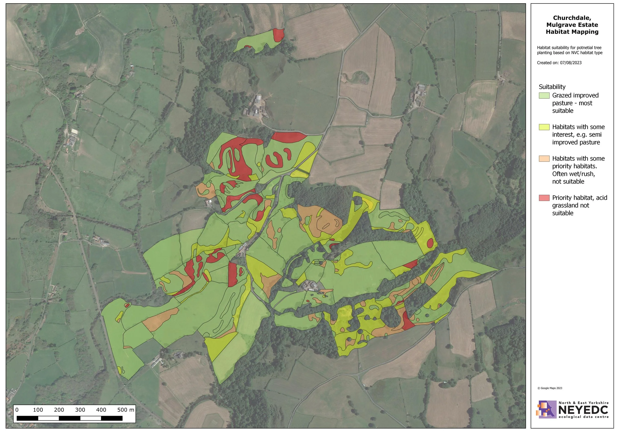
Read MoreSeptember 2024’s Map of the Month shows a tree planting suitability assessment of Churchdale, on Mulgrave Estate!
Read MoreJuly 2024’s Map of the Month shows hedgehog records from Molescroft Parish!
Read MoreJune 2024’s Map of the Month shows the recording zones for a bioblitz at Hell Wath Nature Reserve, as part of the Skell Valley Project!
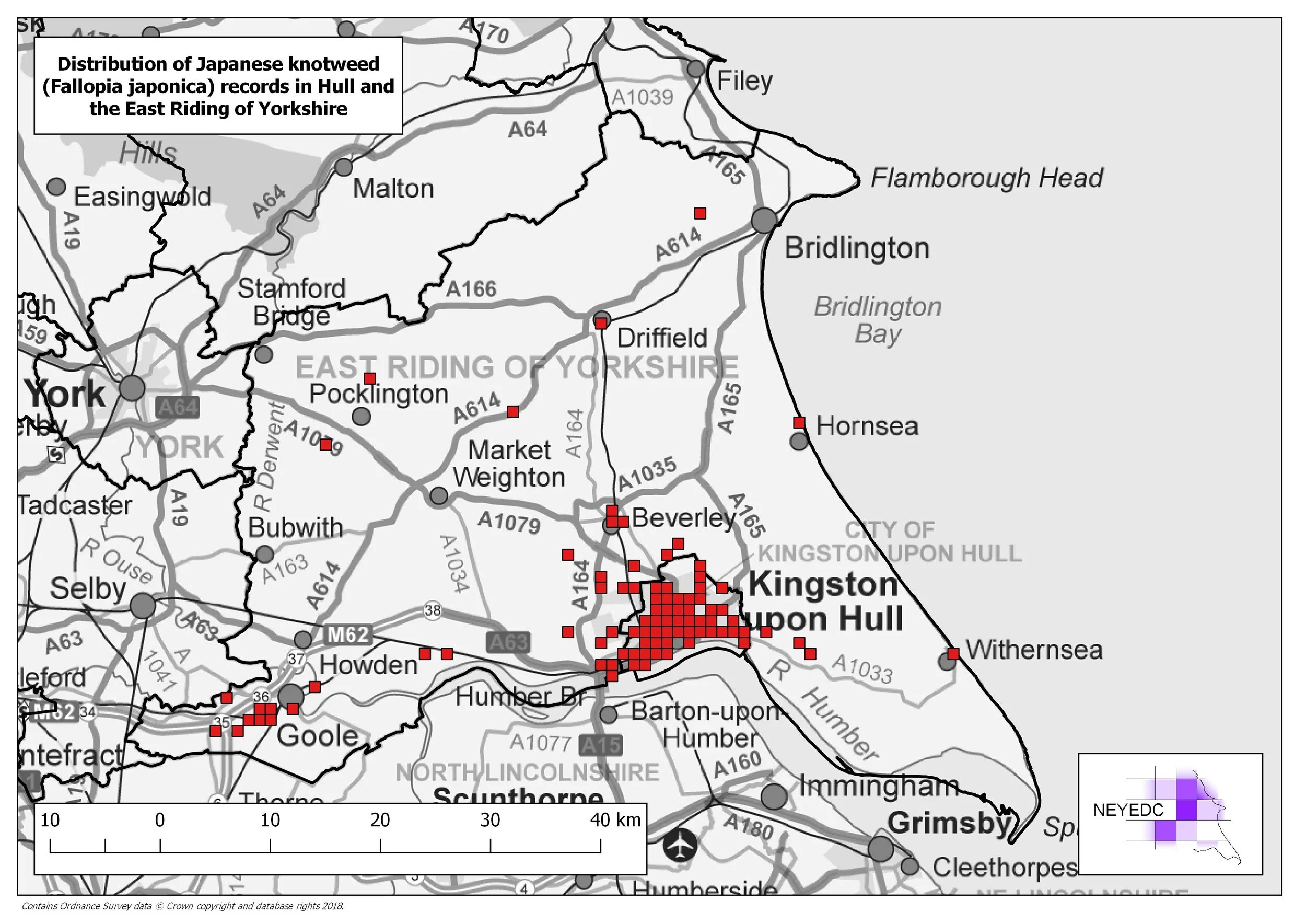
Read MoreMay 2024’s Map of the Month shows the distribution of Japanese Knotweed records in Hull and East Yorkshire!
Read MoreApril 2024’s Map of the Month shows the Top 15 Water Bird Sites in North Yorkshire and important Swale and Ure Water Bird Sites!
Read MoreMarch 2024’s Map of the Month looks at the distribution of Teesdale Violet in Ingleborough NNR!
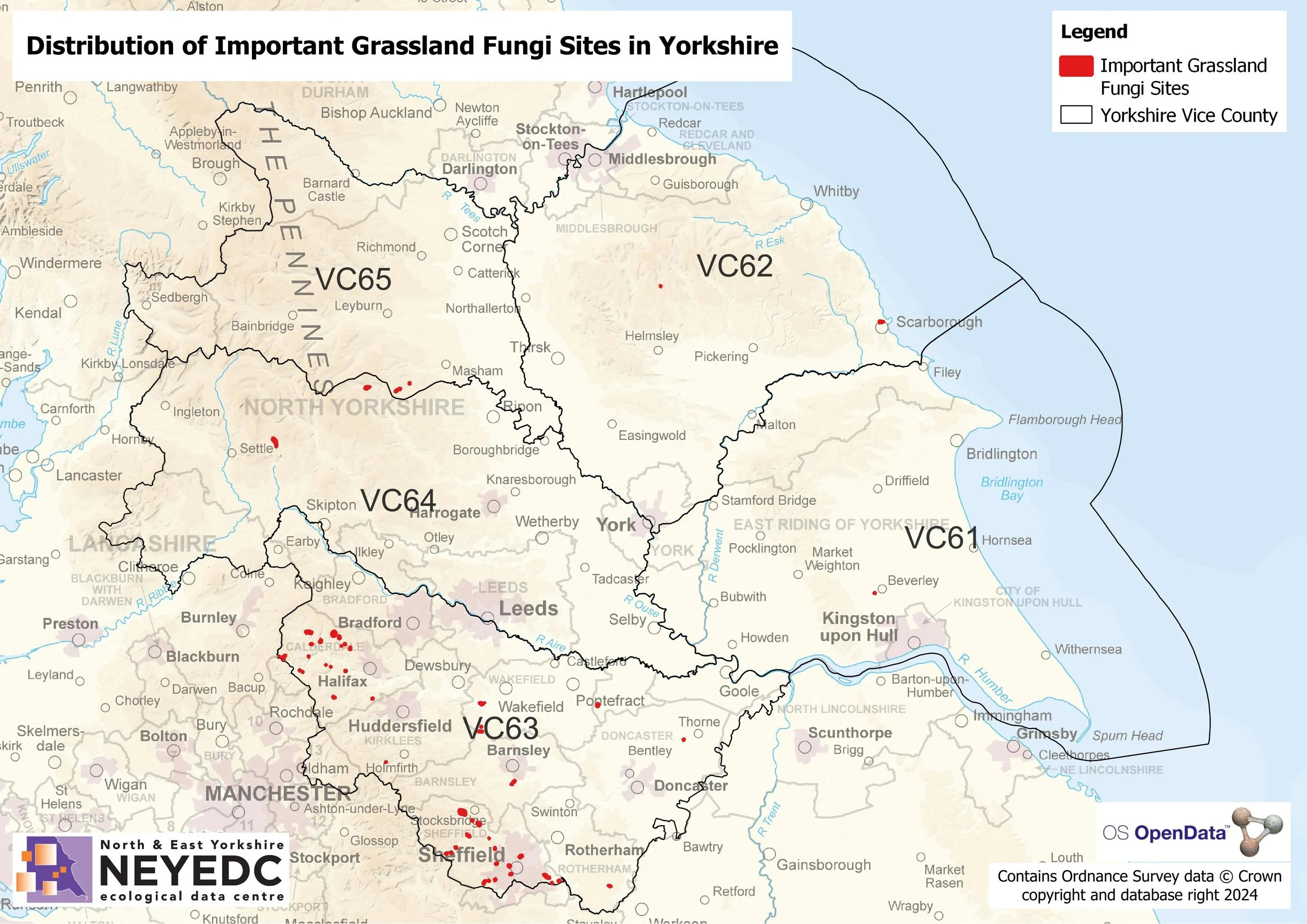
Read MoreFebruary 2024’s Map of the Month looks at Important Grassland Fungi Sites in Yorkshire!
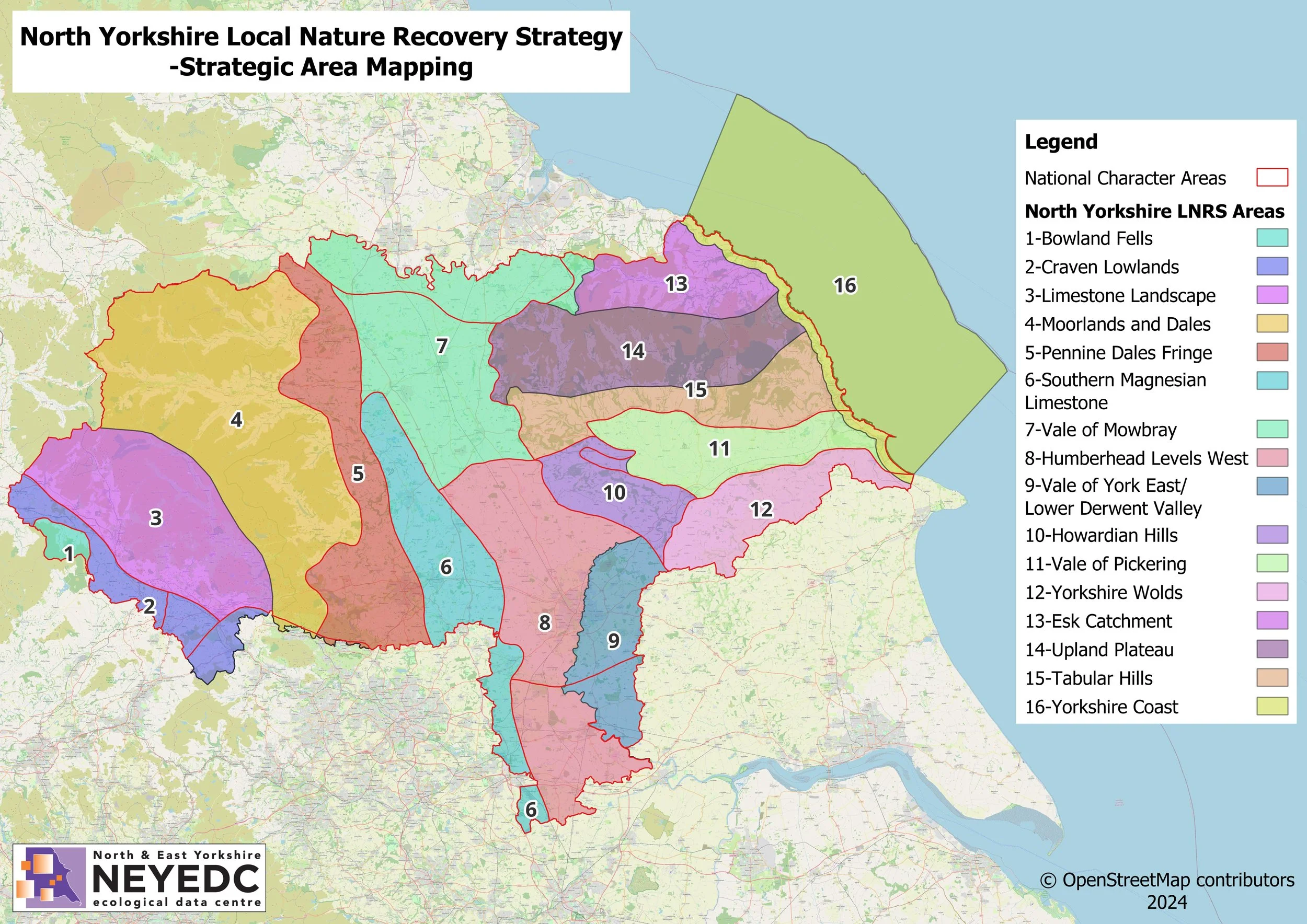
Read MoreJanuary 2024’s Map of the Month looks at the North Yorkshire and York LNRS Strategic Area mapping!
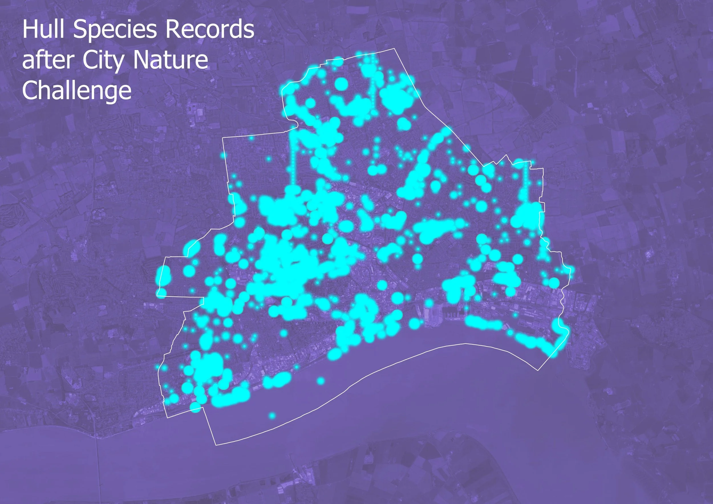
Read MoreDecember 2023’s Map of the Month looks at Hull’s Species Records Before and After City Nature Challenge!
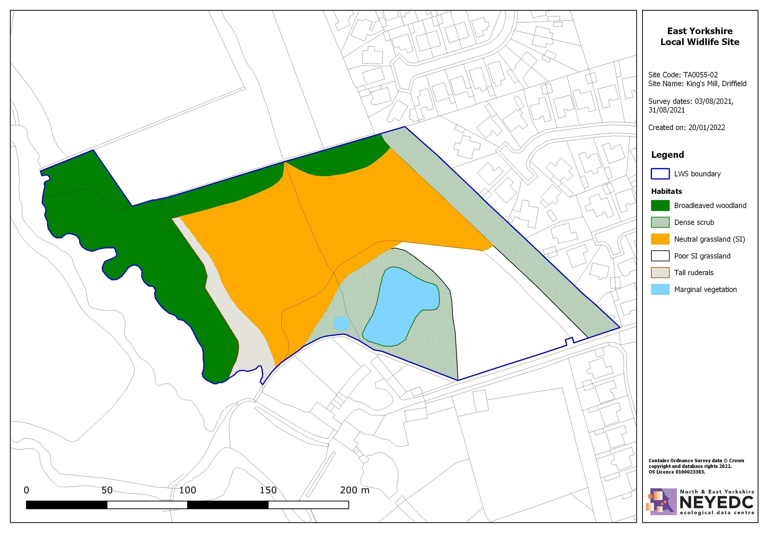
Read MoreNovember 2023’s Map of the Month is a Local Wildlife Site map of King’s Mill, Driffield!
Read MoreOctober 2023’s Map of the Month is a UKHAB map of North Moor, Dawnay Estate!
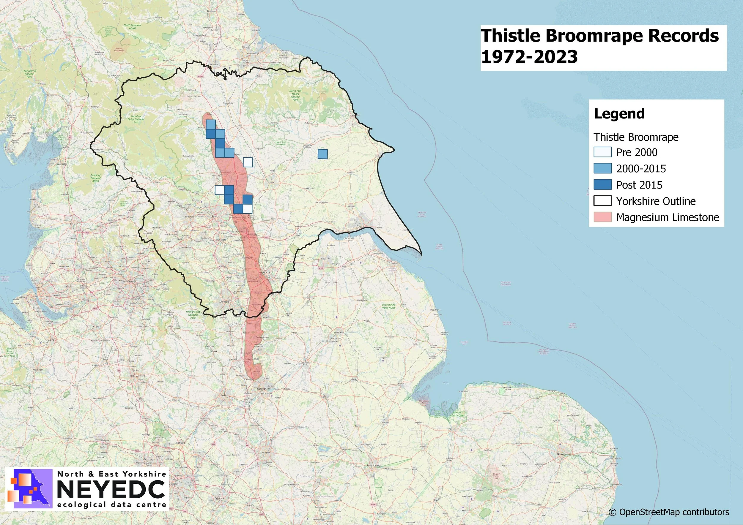
Read MoreSeptember 2023’s Map of the Month is of Thistle Broomrape records from 1972-2023!
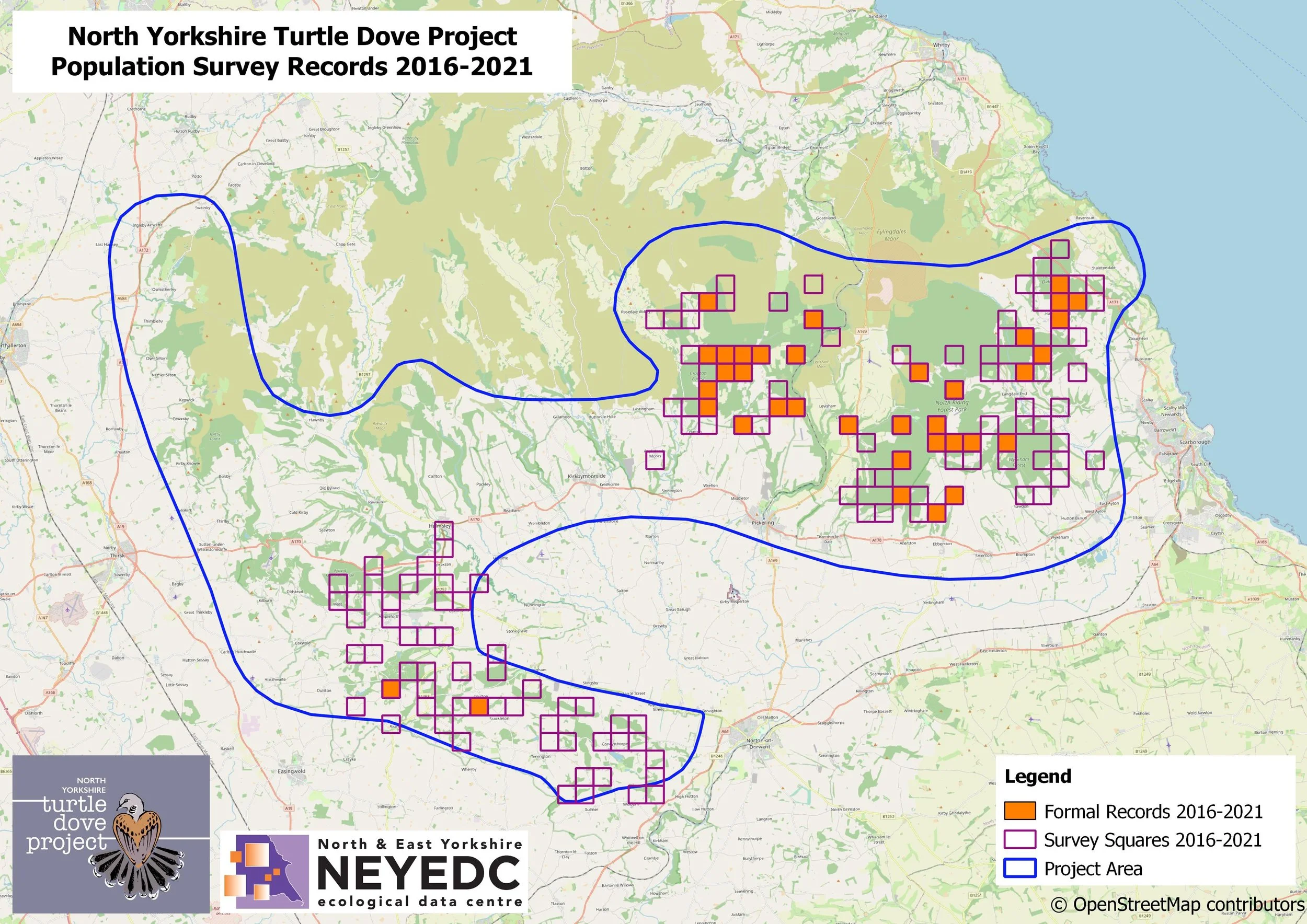
Read MoreAugust 2023’s Map of the Month is from the North Yorkshire Turtle Dove Project!
Read More