Map of the Month - October 2024
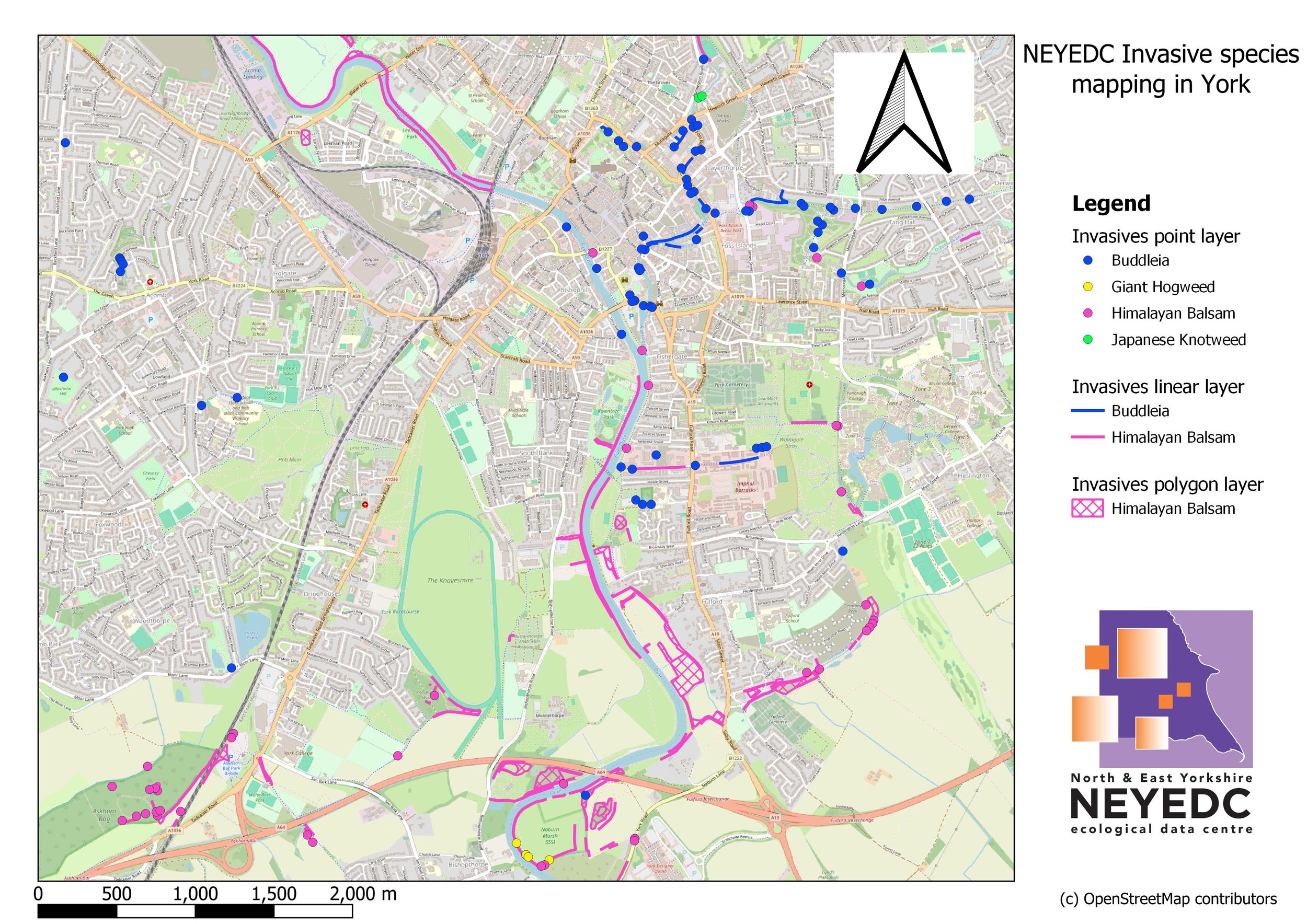
October 2024’s Map of the Month features invasive non-native species (INNS) data collected by NEYEDC staff!
Why Record INNS?
On separate occasions in 2017 and 2019, NEYEDC took a break from processing other people’s data to go and collect some of their own near to their old York office. Species records for INNS are important to planners and conservationists as INNS can threaten biodiversity, damage property, reduce water quality and in some cases cause physical injury to people (e.g. giant hogweed). Having this data can inform the management and mitigation of impacts from these species and help monitor changing trends in distribution over time.
Point, Line or Polygon?
All maps are the result of a series of cartographic decisions, a common dilemma being how information should be displayed. In the map shown above, Himalayan Balsam and Buddleja can grow in such dense stands that recording and mapping each individual plant as a single point feature would be impractical in the field and make the resulting map illegible to read. As such, continuous stands are shown as either line features or polygon features.
You can find INNS ID guides and mapped INNS records on the INNS Mapper: INNS Mapper

