Map of the Month - February 2024
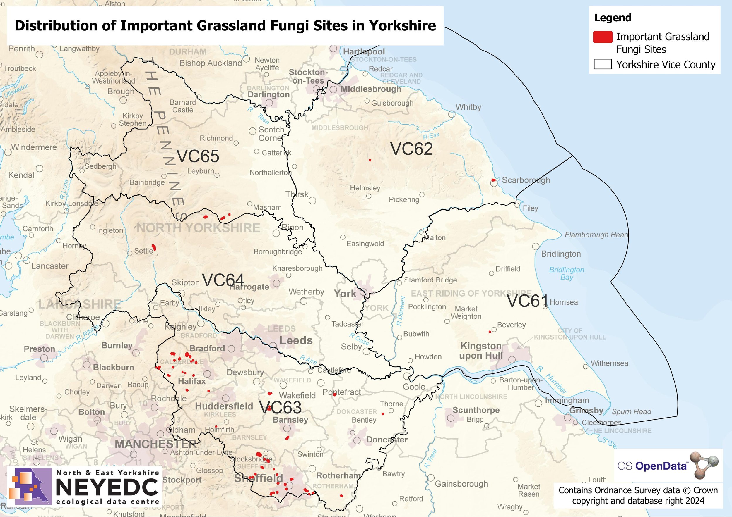
February 2024’s Map of the Month looks at Important Grassland Fungi Sites in Yorkshire!


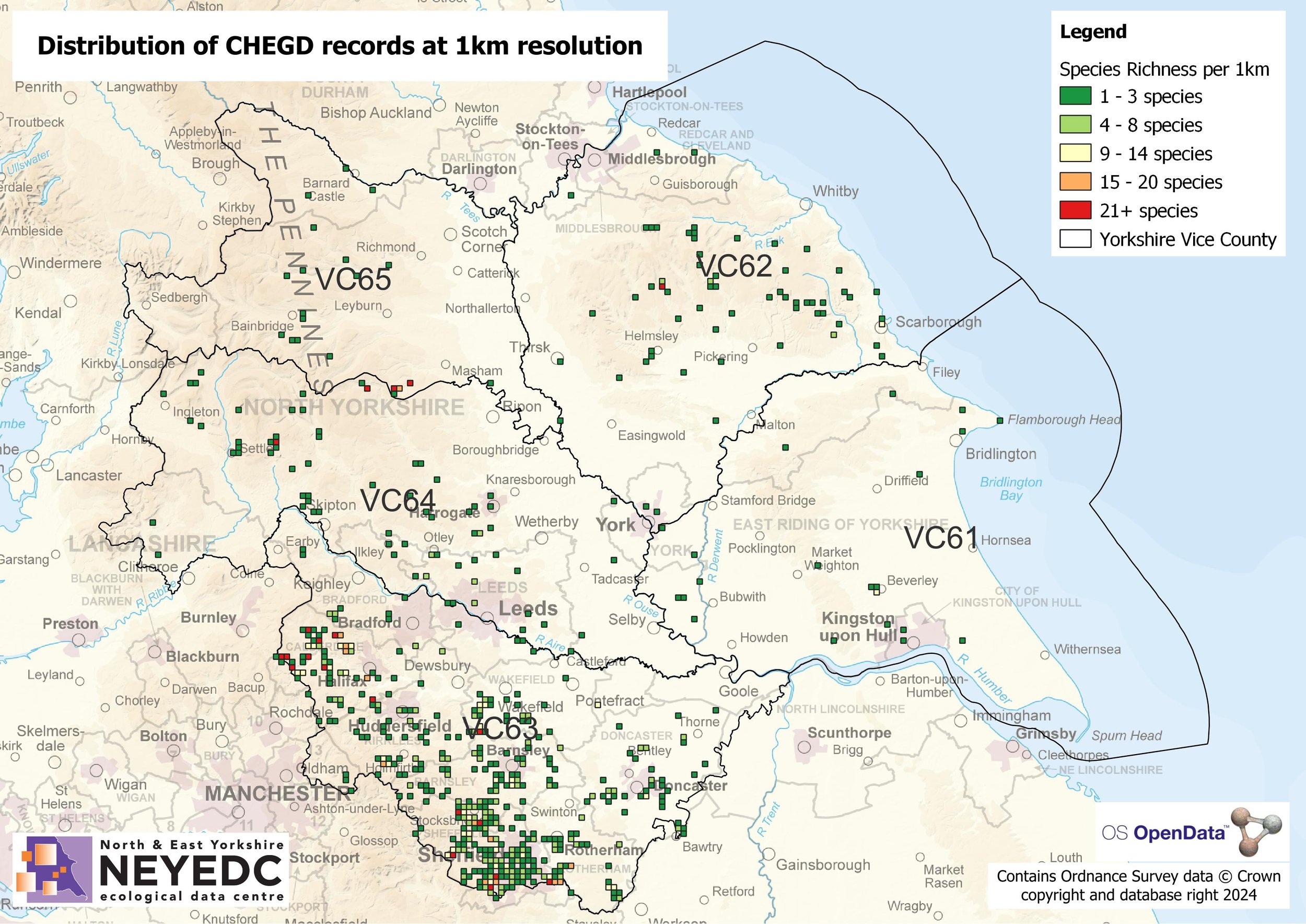
Working with Natural England, NEYEDC have led a Yorkshire-wide project with the other Local Environmental Records Centres (LERCs) in the county to map the location of grassland fungi records that are not on the British Mycological Society's 'Fungal Records Database of Britain and Ireland' with a view to identifying Important Grassland Fungi Sites. The first step was to create a 1km distribution map of the records, before drilling down and mapping the data at 100m resolution. The combination of these two distribution maps led to the identification of clusters of records that could form a coherent site boundary, with the total number of 'CHEGD' species recorded within each site being of at least regional importance, or forming an assemblage of 10+ species across all families. A total of 56 sites have been identified across Yorkshire, with definite clusters of sites in VC63. This reflects the recording effort as seen in the second 1km distribution map, and reiterates the need for ongoing survey work throughout the rest of Yorkshire; something NEYEDC's fungi-rich grassland projects are addressing. We hope that the number and distribution of Important Grassland Fungi Sites across Yorkshire will increase in coming years - watch this space!
For further information on the fungi-grassland projects NEYEDC are currently involved in read our blog post from December 2023, or check out our waxcap webpage.
