Map of the Month - January 2024
January 2024’s Map of the Month looks at the North Yorkshire and York LNRS Strategic Area mapping!
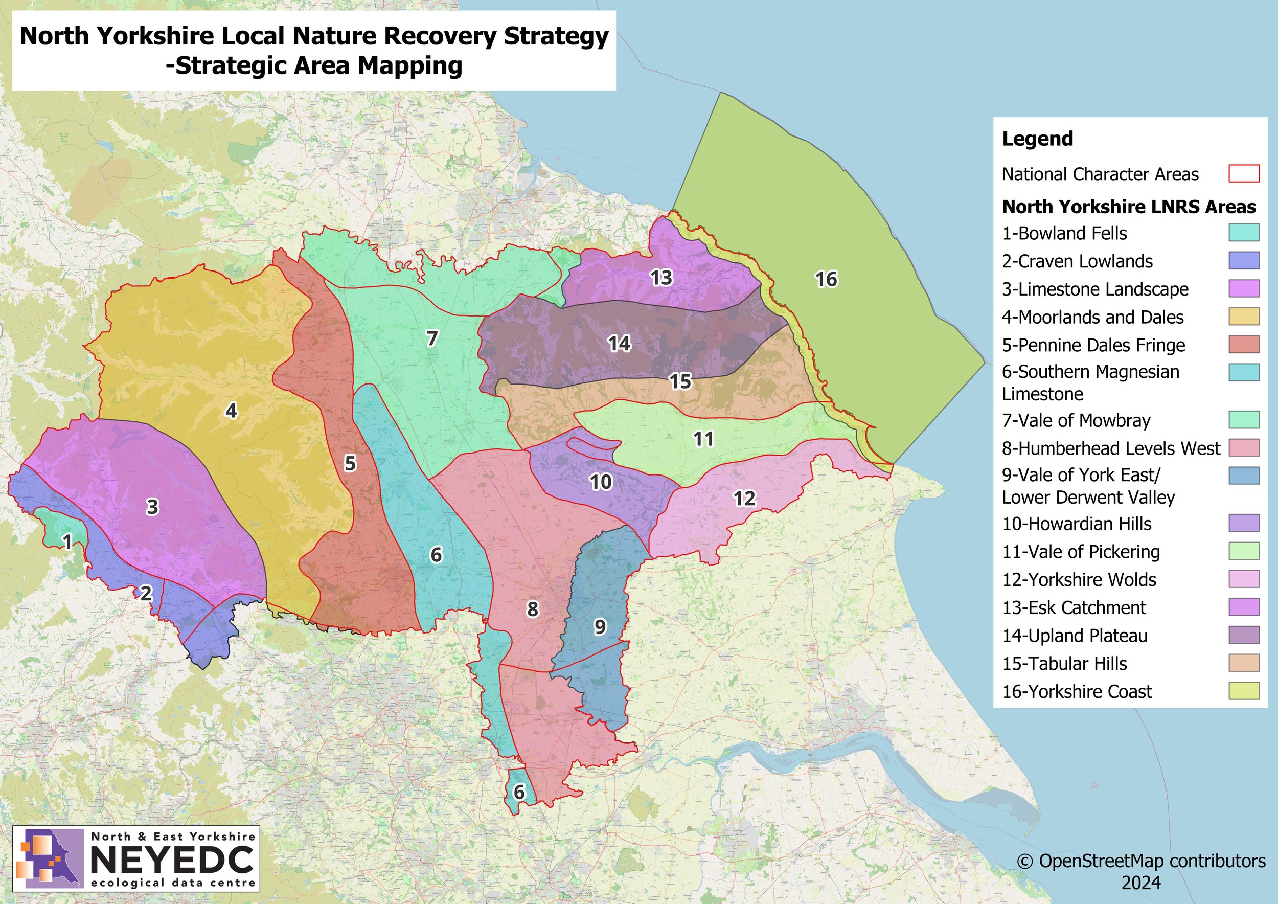
We are supporting the development of the Local Nature Recovery Strategy (LNRS) for North Yorkshire and York (as well as Hull & East Yorkshire). The LNRS is a new, collaborative approach introduced by the UK government to restore and create healthy habitats, increase biodiversity, and improve access to nature in local areas. This map, initially based on National Character Areas, but with more data to be added, shows what makes North Yorkshire and York LNRS area different to other regions, and how habitats and species vary around the area. National Character Areas divide England into 159 distinct natural areas. Each is defined by a unique combination of landscape, biodiversity, geodiversity, history, and cultural and economic activity. Their boundaries follow natural lines in the landscape rather than administrative boundaries. This mapping will develop over time and help us identify where the best opportunities to support nature recovery will be located, one of the first steps in the LNRS process.
We’ll be updating our website and social media channels with more information on our involvement in the LNRS process in the coming weeks.
To find out more about Local Nature Recovery Strategies, visit: Local nature recovery strategies - GOV.UK (www.gov.uk), Local Nature Recovery Strategy | North Yorkshire Council