Map of the Month - November 2023
November 2023’s Map of the Month is a Local Wildlife Site map of King’s Mill, Driffield!
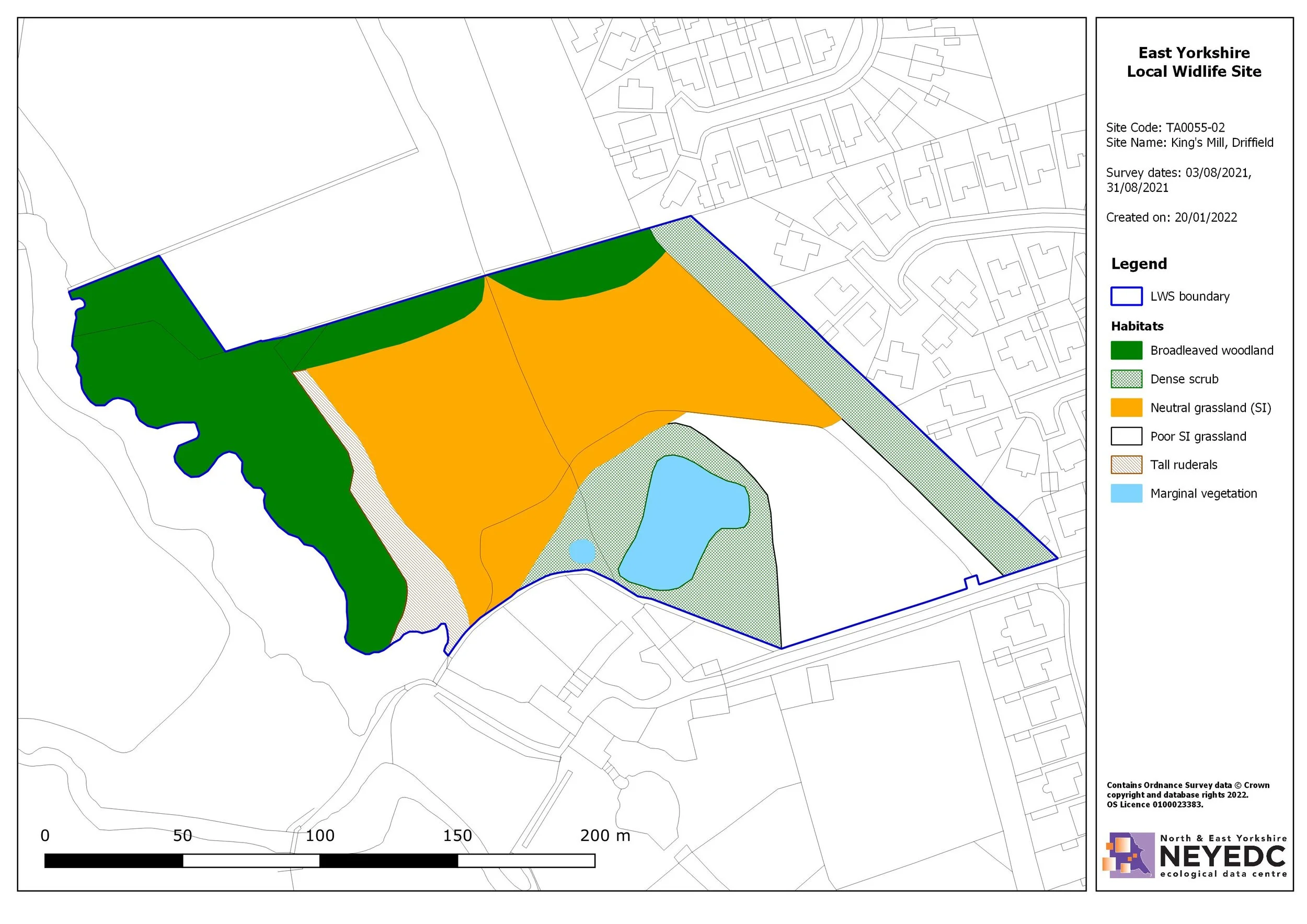
A core function of many Local Environmental Records Centres (LERCs) is to support local authorities and wildlife trusts in managing their Local Wildlife Sites system. NEYEDC completes this function on behalf of City of York Council, East Riding of Yorkshire Council and North Yorkshire Council and their respective site systems. This map is from a recent 2021 survey of Kings Mill, Driffield and identifies the habitats present using Phase 1 standard. NEYEDC is currently translating the habitat classification of all Local Wildlife Sites mapping from Phase 1 to UKHab methodology so to better integrate with emerging government plans associated with the Environment Act.
To find out more about the East Yorkshire Local Wildlife Site system you can visit: https://www.eastriding.gov.uk/environment/sustainable-environment/nature-conservation-and-wildlife/important-sites-for-wildlife/ and you can find out more about UKHab here: https://ukhab.org/about-ukhab/