Map of the Month - April 2024
April 2024’s Map of the Month shows the Top 15 Water Bird Sites in North Yorkshire and important Swale and Ure Water Bird Sites!
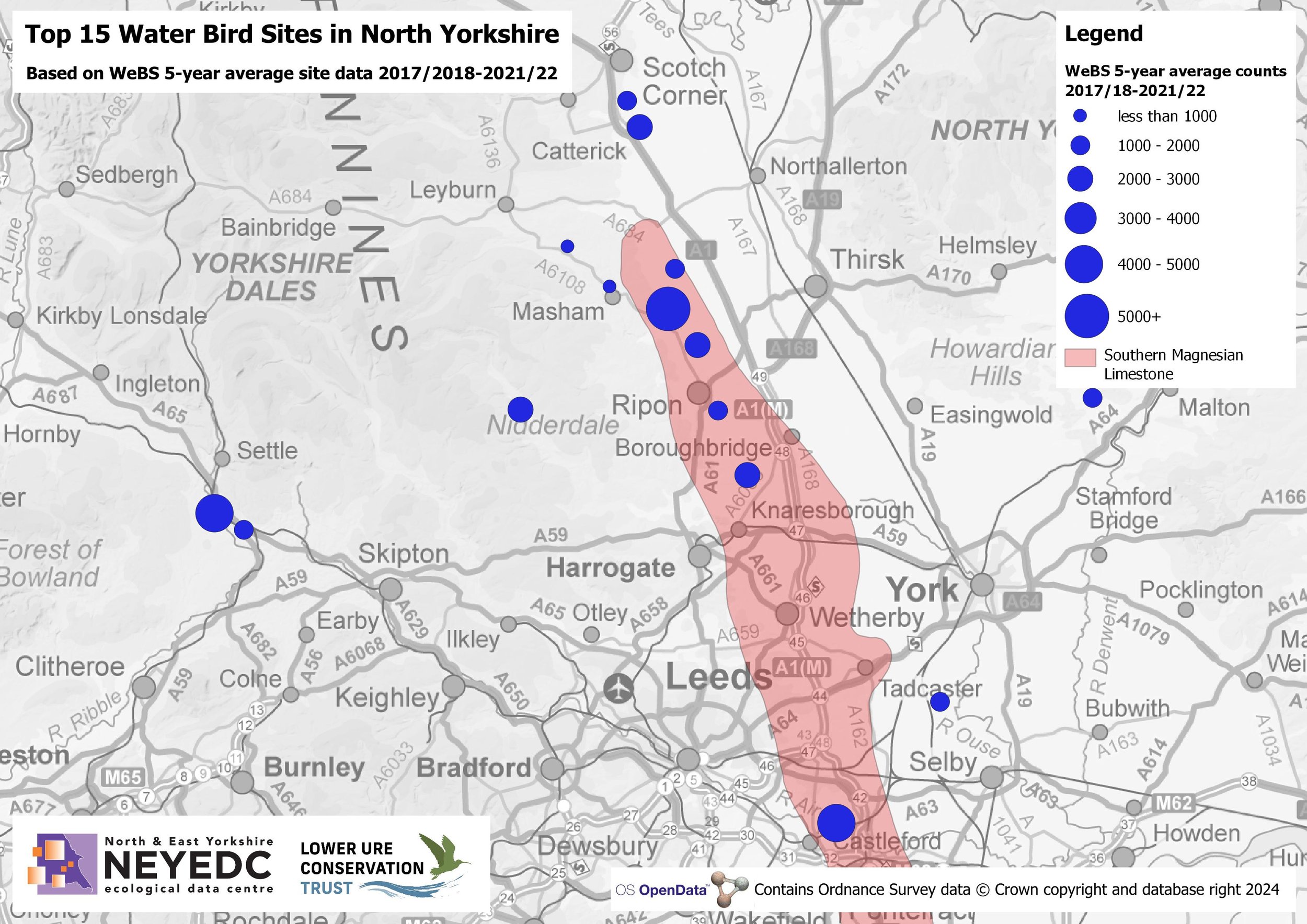
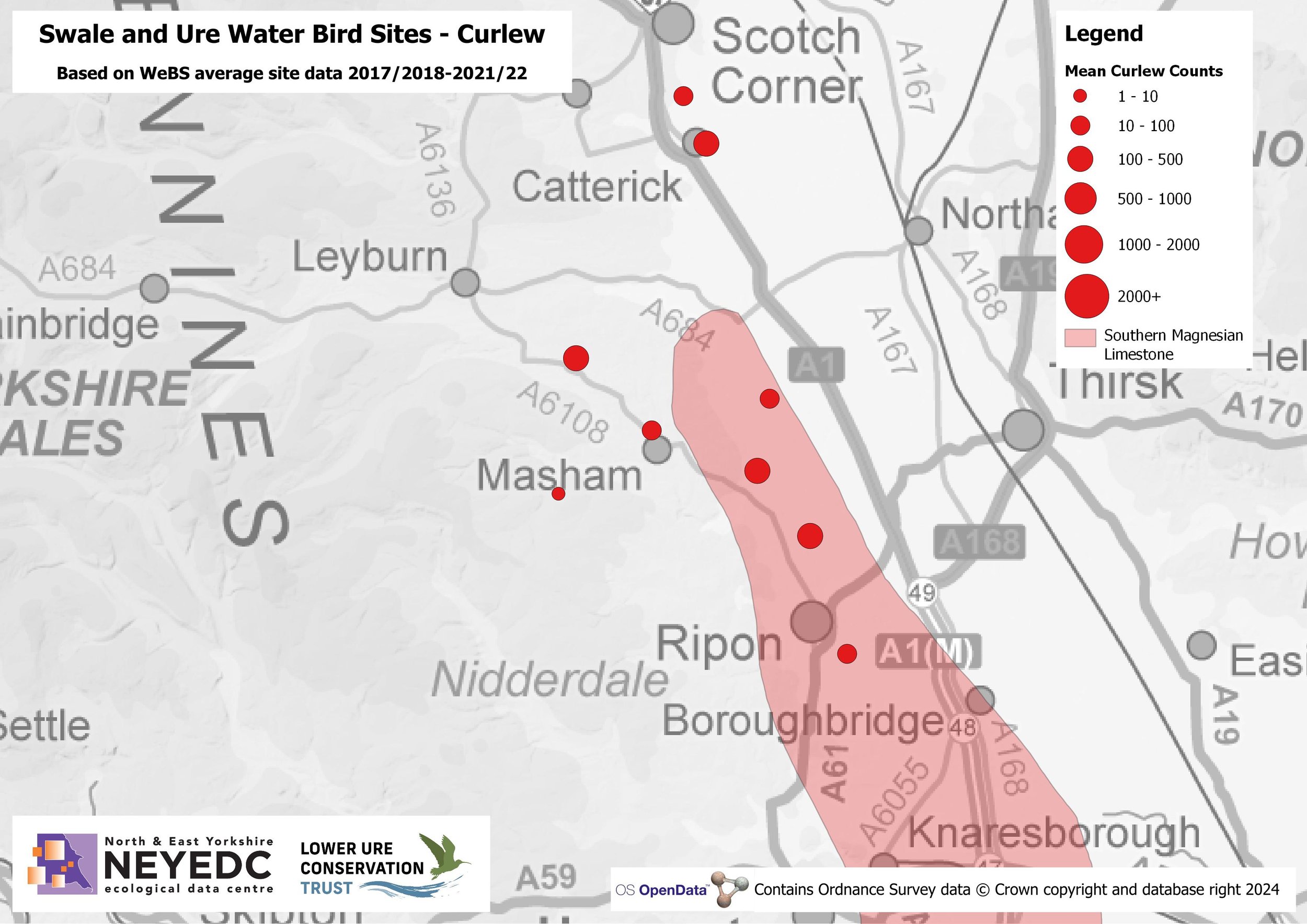
Some recent work with The Lower Ure Conservation Trust (LUCT) has been to map the Top 15 water bird sites in North Yorkshire using the British Trust for Ornithology's (BTO's) freely available WeBS site data. It's clear to see the importance of the sites in the Lower Ure valley located on Southern Magnesian Limestone - often the result of habitat restoration following many years of gravel extraction. The data was then drilled down further by Judith Hooper, to look at specific bird counts for a series of ten sites in the Ure and Swale catchments, identifying species where this suite of sites supports greater than 1% of the current GB population. The second map shows mean counts of Curlew (Numenius arquata), which has a combined 5-year mean count (2017/18 - 2021/22) of over 1500 birds.
You can read more about the Lower Ure Conservation Trust here and follow Nosterfield NNR on Twitter at @NosterfieldLNR.